S1 Streets
What S1 does
S1 turns the city’s street lines into a network of segments and junctions, and records who may use each segment. Every later system walks or drives on this network, so it has to be right first. The rules I assumed decide who may walk or drive where. I check the result twice: against itself in the tests, and against the street, with photos, in Checks and decisions.
Words
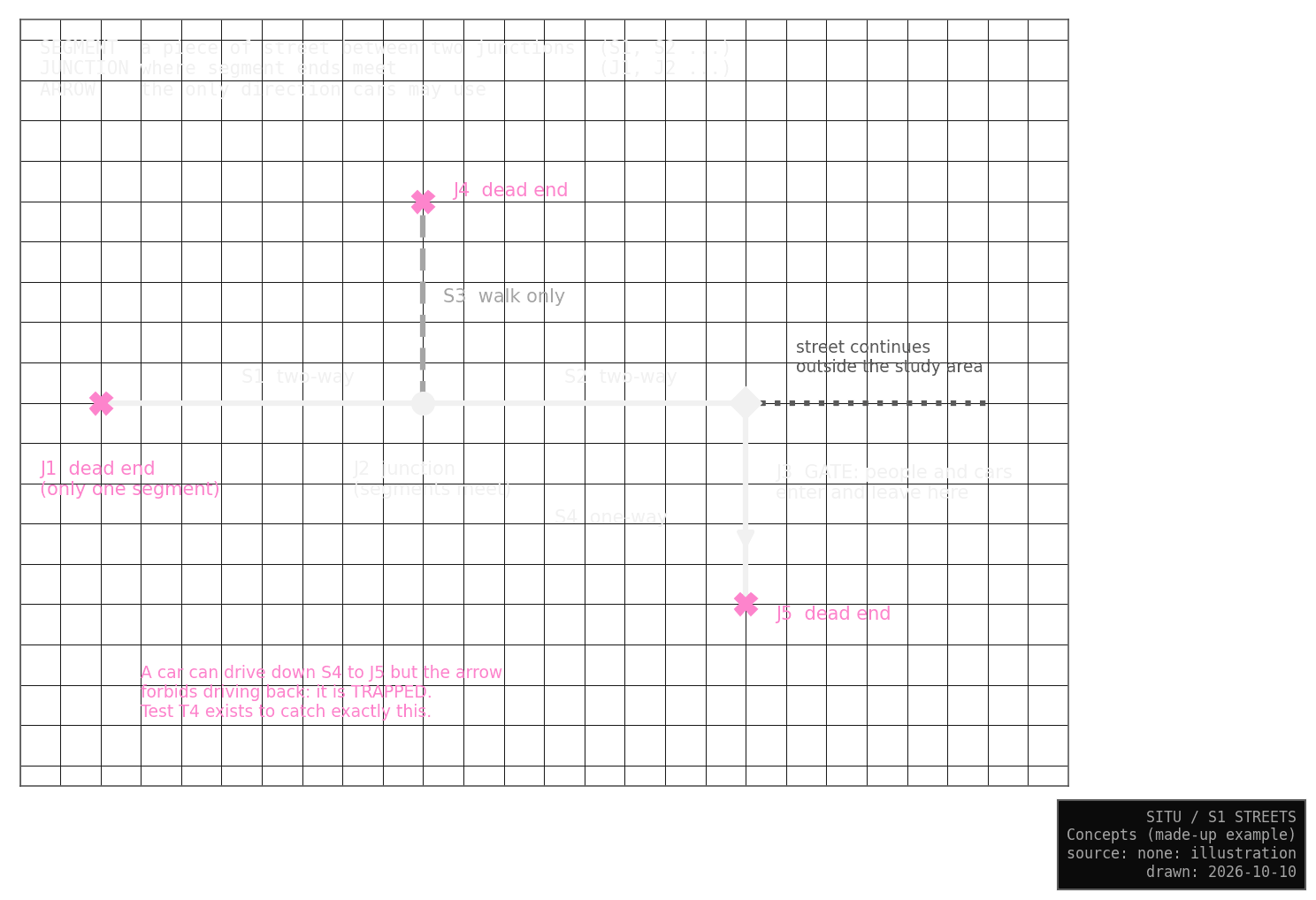
A segment is a piece of street between two junctions, and a junction is where segment ends meet. Griffintown stays part of the city, so S1 also keeps the streets just outside the boundary that touch the study area. I call them the edge. A gate is where the study area meets the edge, and an exit is the far end of an edge street, where the city carries on. A dead end is a junction with only one segment that is neither a gate nor an exit. A one-way arrow shows the only direction cars may use; pedestrians may always walk both ways. A checkpoint, with an id starting with C, is a place where I doubted the data and took a decision from photos.
S1 starts from the city’s street lines, the same lines my space syntax analysis uses. Space syntax is the method Bill Hillier and Julienne Hanson began for describing where each street sits in the whole network; S2 attaches its values to S1. Every segment keeps the city’s own id, so any value can be traced back to its source.
Result
232 segments inside · 32 on the edge
Before the checks, S1 had 190 segments and 12 dead ends. Now it has 2 dead ends. A road map is a poor walking map: the city’s file left out the canal path and the new park paths, and 10 of the 12 dead ends turned out to be places where walkers continue.
What changed in October
The October rebuild came from decisions about the boundary and a few street ends. Every segment and junction that existed before kept its number.
The boundary is a drawing decision. The city codes Boulevard Robert-Bourassa as a pair of one-way roads about 60 m apart, and the boundary ran between them, so inside the study area the boulevard carried traffic one way only. S1 now takes in both carriageways (C19) and keeps the edge around the whole area.
At the street ends, the Lachine Canal path (C16) and two park paths (C18) came in for walkers. A footway now runs from the end of Brennan through the block to de la Commune (C04, C12), and the end of Ann joins it (C05). These links are assumed, and drawn in pink until a photo or a visit confirms them. From the end of Smith, a 41 m link crosses the plaza of Place des Aiguilleurs (C06); that one was settled with photos.
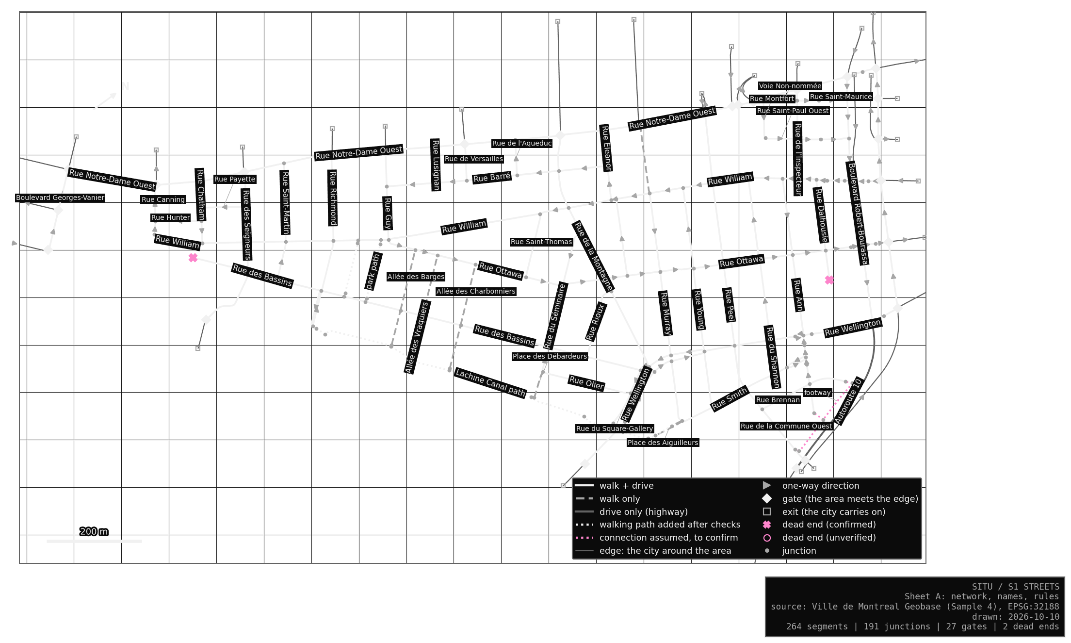
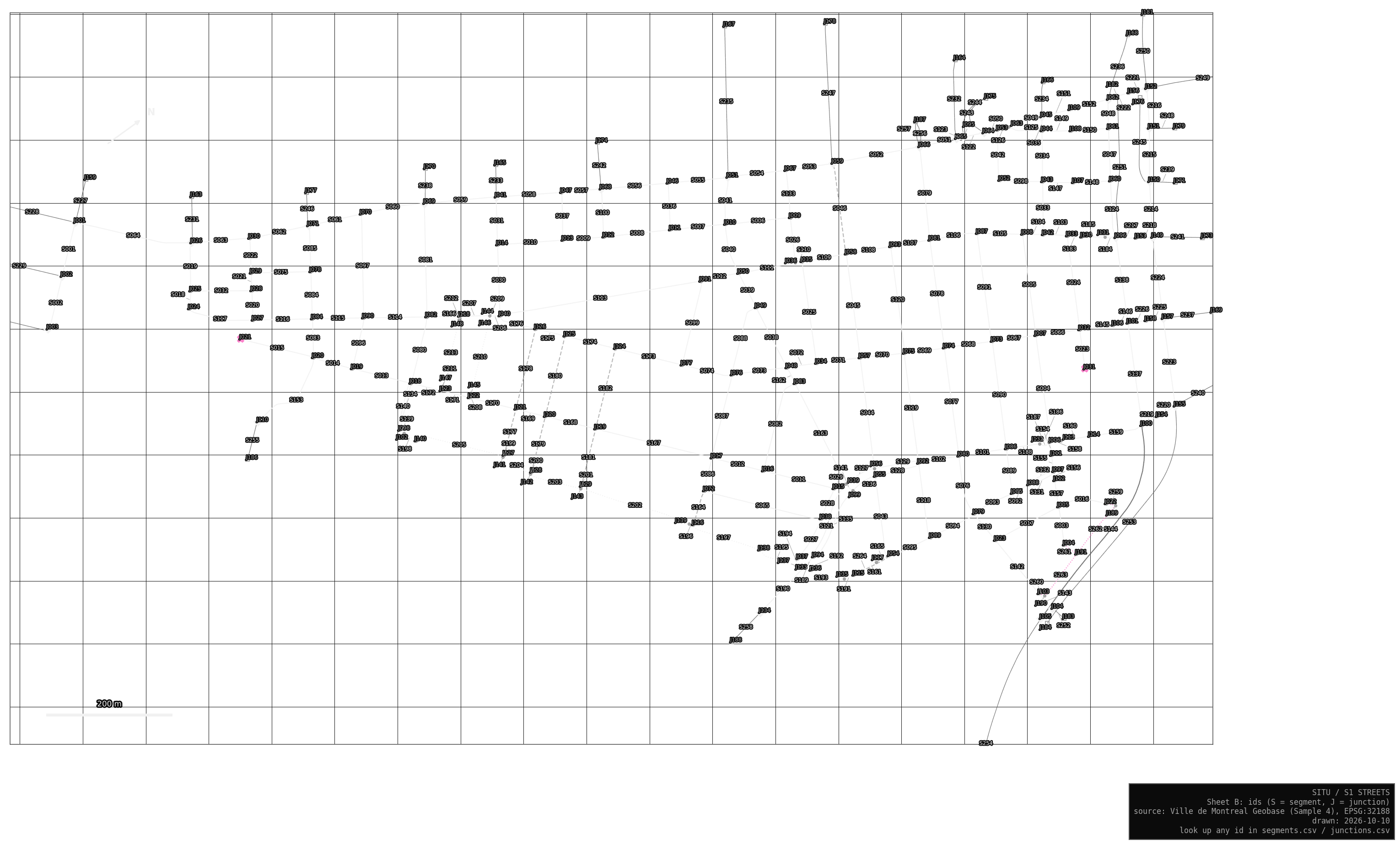
The sheets are turned so the street grid sits level. The data itself is never turned, and the N arrow points to true north.
From here to there
In the Lab, choose S1, then “from here to there”, and click a start and an end junction. Everything it shows comes from the network alone:
| Measure | What it tells you |
|---|---|
| Shortest route | the shortest way along the streets, on foot or by car; the other measures are compared with it |
| Directness | route length divided by the straight line; a grid gives about 1.3, and a barrier such as the canal pushes it higher |
| Variety | in pink, every street a trip at most 0, 5, 10, 25 or 50 % longer than the shortest could use; a thin band means the layout funnels everyone onto one street |
| Cost of one-way streets | how much longer the drive is than the walk between the same two junctions |
From William at Young to further along William is 306 m on foot and 966 m by car, because William is one-way and the car has to go round the block. From Bassins at Rioux to Notre-Dame at Robert-Bourassa, a 10 % detour opens up 82 other segments, the grid giving walkers many ways. From Bassins at Allée des Barges to Wellington, the walk is 1.7 times the straight line, because the canal has few crossings.
These measures say nothing about how anyone actually chooses a route: people do not all take the shortest way, and the turn bans and stops of S3 are left out. Routes also stay inside the study area, so many trips by car need the city outside, and the Lab says so when that happens. How people choose belongs to S9, which can measure any route it imagines against this yardstick. The Lab notes describe how the measures themselves are tested.